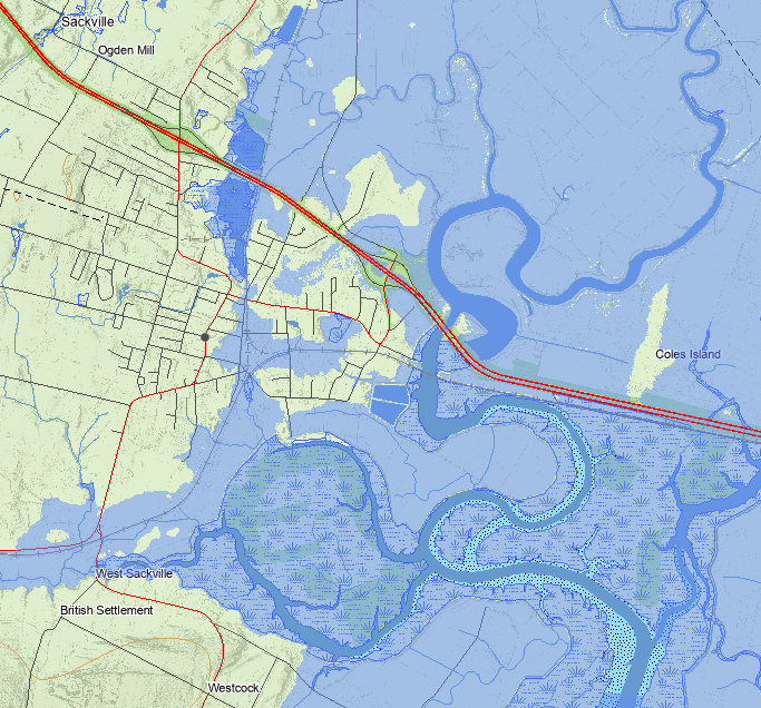
The province has released an updated floodplain mapping tool that can help identify areas prone to one-in-20-year and one-in-100-year floods. The tool predicts flood zones based on present day risk, as well as future risk, considering the effects of climate change and sea level rise.
The map is searchable by address or property ID number, can show several layers of information customizable by the user.
The image of downtown Sackville shows a town divided in terms of flood risk, with areas to the east of Main Street mostly included in flood risk zones, and areas to the west of Main, mostly spared.

The CN rail line that runs through town is almost completely enclosed in the one-in-20-year flood risk zone. From just west of Woodpoint Road through to Aulac, the only place the line is not included in the floodplain zone is in a small area near the intersection of Crescent and Bridge Streets.
Another major piece of infrastructure in the most prone flood zone: Sackville’s sewage lagoons on the edge of the Tantramar River, which is fully enclosed in a one-in-20-year flood risk zone.

On Thursday, Sackville CAO Jamie Burke presented to the New Brunswick legislature climate change committee. CHMA will bring you highlights from his presentation on Monday’s Tantramar Report.
In their announcement, the province says the new map tool uses, “the latest information and modeling technology to identify areas at risk and incorporates the effects of climate change.”
The Department of Environment will host online sessions next week to introduce residents to how to use the tool and what floodplain mapping means for them. Pre-registration is required for the Zoom sessions, which are offered in both languages.
Three different dates are on offer:


